|
| ||||||||||||||||||||
Please note that JDLand is no longer being updated.
peek >>
Near Southeast DC Past News Items
- Full Neighborhood Development MapThere's a lot more than just the projects listed here. See the complete map of completed, underway, and proposed projects all across the neighborhood.
- What's New This YearA quick look at what's arrived or been announced since the end of the 2018 baseball season.
- Food Options, Now and Coming SoonThere's now plenty of food options in the neighborhood. Click to see what's here, and what's coming.
- Anacostia RiverwalkA bridge between Teague and Yards Parks is part of the planned 20-mile Anacostia Riverwalk multi-use trail along the east and west banks of the Anacostia River.
- Virginia Ave. Tunnel ExpansionConstruction underway in 2015 to expand the 106-year-old tunnel to allow for a second track and double-height cars. Expected completion 2018.
- Rail and Bus Times
Get real time data for the Navy Yard subway, Circulator, Bikeshare, and bus lines, plus additional transit information. - Rail and Bus Times
Get real time data for the Navy Yard subway, Circulator, Bikeshare, and bus lines, plus additional transit information. - Canal ParkThree-block park on the site of the old Washington Canal. Construction begun in spring 2011, opened Nov. 16, 2012.
- Nationals Park21-acre site, 41,000-seat ballpark, construction begun May 2006, Opening Day March 30, 2008.
- Washington Navy YardHeadquarters of the Naval District Washington, established in 1799.
- Yards Park5.5-acre park on the banks of the Anacostia. First phase completed September 2010.
- Van Ness Elementary SchoolDC Public School, closed in 2006, but reopening in stages beginning in 2015.
- Agora/Whole Foods336-unit apartment building at 800 New Jersey Ave., SE. Construction begun June 2014, move-ins underway early 2018. Whole Foods expected to open in late 2018.
- New Douglass BridgeConstruction underway in early 2018 on the replacement for the current South Capitol Street Bridge. Completion expected in 2021.
- 1221 Van290-unit residential building with 26,000 sf retail. Underway late 2015, completed early 2018.

- NAB HQ/AvidianNew headquarters for National Association of Broadcasters, along with a 163-unit condo building. Construction underway early 2017.

- Yards/Parcel O Residential ProjectsThe Bower, a 138-unit condo building by PN Hoffman, and The Guild, a 190-unit rental building by Forest City on the southeast corner of 4th and Tingey. Underway fall 2016, delivery 2018.

- New DC Water HQA wrap-around six-story addition to the existing O Street Pumping Station. Construction underway in 2016, with completion in 2018.

- The Harlow/Square 769N AptsMixed-income rental building with 176 units, including 36 public housing units. Underway early 2017, delivery 2019.

- West Half Residential420-unit project with 65,000 sf retail. Construction underway spring 2017.
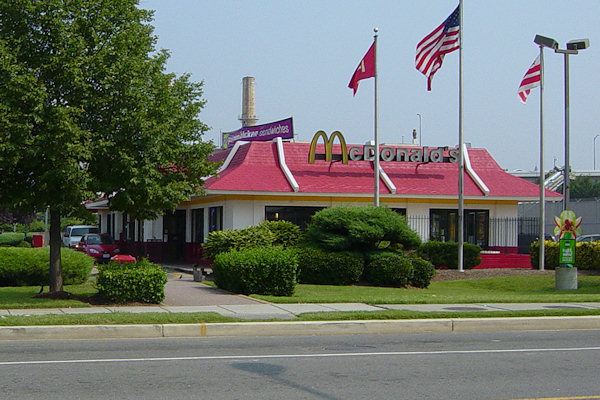
- Novel South Capitol/2 I St.530ish-unit apartment building in two phases, on old McDonald's site. Construction underway early 2017, completed summer 2019.
- 1250 Half/Envy310 rental units at 1250, 123 condos at Envy, 60,000 square feet of retail. Underway spring 2017.
- Parc Riverside Phase II314ish-unit residential building at 1010 Half St., SE, by Toll Bros. Construction underway summer 2017.
- 99 M StreetA 224,000-square-foot office building by Skanska for the corner of 1st and M. Underway fall 2015, substantially complete summer 2018. Circa and an unnamed sibling restaurant announced tenants.
- The Garrett375-unit rental building at 2nd and I with 13,000 sq ft retail. Construction underway late fall 2017.
- Yards/The Estate Apts. and Thompson Hotel270-unit rental building and 227-room Thompson Hotel, with 20,000 sq ft retail total. Construction underway fall 2017.
- Meridian on First275-unit residential building, by Paradigm. Construction underway early 2018.
- The Maren/71 Potomac264-unit residential building with 12,500 sq ft retail, underway spring 2018. Phase 2 of RiverFront on the Anacostia development.
- DC Crossing/Square 696Block bought in 2016 by Tishman Speyer, with plans for 800 apartment units and 44,000 square feet of retail in two phases. Digging underway April 2018.
- One Hill South Phase 2300ish-unit unnamed sibling building at South Capitol and I. Work underway summer 2018.
- New DDOT HQ/250 MNew headquarters for the District Department of Transportation. Underway early 2019.
- 37 L Street Condos11-story, 74-unit condo building west of Half St. Underway early 2019.
- CSX East Residential/Hotel225ish-unit AC Marriott and two residential buildings planned. Digging underway late summer 2019.
- 1000 South Capitol Residential224-unit apartment building by Lerner. Underway fall 2019.
- Capper Seniors 2.0Reconstruction of the 160-unit building for low-income seniors that was destroyed by fire in 2018.
- Chemonics HQNew 285,000-sq-ft office building with 14,000 sq ft of retail. Expected delivery 2021.
2918 Blog Posts Since 2003
Go to Page: 1 | ... 15 | 16 | 17 | 18 | 19 | 20 | 21 | 22 | 23 ... 292
Search JDLand Blog Posts by Date or Category
Go to Page: 1 | ... 15 | 16 | 17 | 18 | 19 | 20 | 21 | 22 | 23 ... 292
Search JDLand Blog Posts by Date or Category
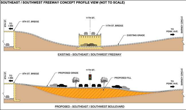
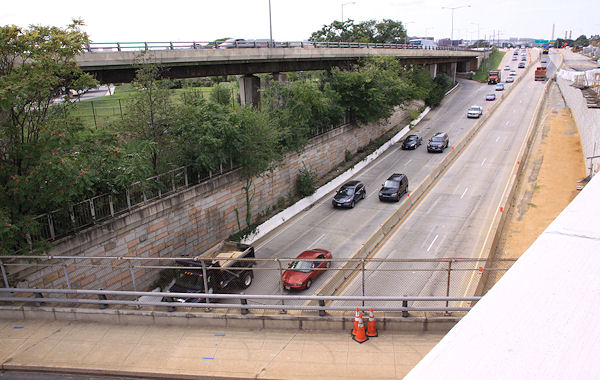 The next step in converting the sunken portion of the Southeast Freeway between 8th Street SE and Pennsylvania Avenue to the eventual at-grade "Southeast Boulevard" is coming, as DDOT has announced that on Jan. 31, "all eastbound lanes along this stretch will be closed to traffic for approximately 18-20 months while crews fill the roadway to restore it to the local street elevation."
 This will be preceded by for a week or so beginning around noontime on Tuesday, Jan. 22, with the route being reduced to only one lane.
 Not only are these closures to allow for the filling-in of much of the old roadway, but also to start construction of bridge piers for "a new bridge over the SE Freeway," which I believe will be the new three-lane flyover ramp from the freeway to the outbound 11th Street Bridge, replacing the current one (seen at top left in the photo).
If you're worked up about this closure because you're using the route to Pennsylvania Avenue to then use the left-turn-to-DC295, you should already be using the new exit ramp from the outbound 11th Street Bridge directly to northbound 295 anyway!
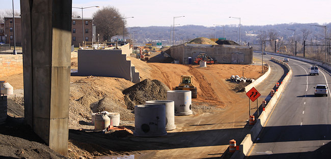 The work of bringing in lots and lots (and lots and lots) of dirt to build up the sunken route has already begun on the old westbound side of the road, as seen in this photo I took earlier this month, when I also updated the before and afters for the 11th Street & not-yet-Southeast-Blvd intersection.
If you haven't been following this project, which is part of the $90 million second phase of the 11th Street Bridges project, the filling-in is so there will be an at-grade signalized intersection at 11th Street, SE. Drivers will arrive at the new intersection from the SE Freeway (or Pennsylvania Avenue) and have the option of getting onto 11th Street, or continuing straight. There will also be a new stretch of 12th Street north of M to Southeast Blvd., so that drivers exiting the 11th Street freeway bridges can continue north across M to the new boulevard, instead of turning left onto M and then right onto 11th.
There is also supposed to be a new pedestrian/cycling trail alongside this new Southeast Blvd., creating another connection between Virginia Avenue Park and Barney Circle than using the currently-ripped-up-by-DC-Water M Street route.
This construction drawing shows all the new intersections, ramps, flyovers, and whatnot for both phases of the project on the west side of the river, if you need some help visualizing.
There are also supposed to be public meetings coming this year as part of studies now underway on how to remake the Barney Circle-not-yet-Southeast-Blvd interchange.
|
Comments (1)
|
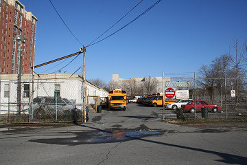
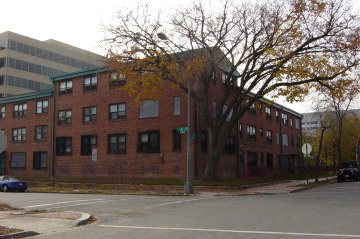
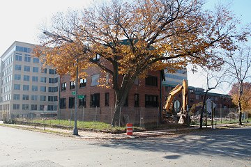
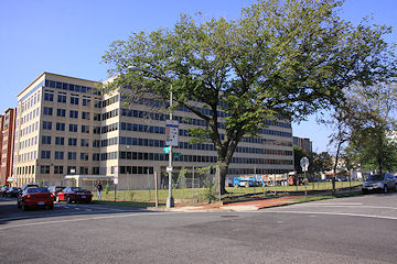
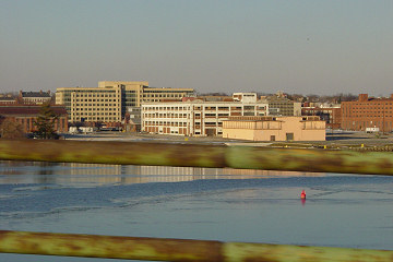
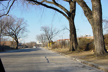
(Warning: Navel gazing ahead!)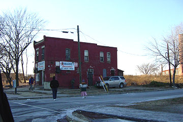 Even in my semi-retired state, I'd like to believe it is still worth noting that Saturday marks the 10-year anniversary of my first real photographic excursion* south of the Southeast Freeway, when on lark on a cold Sunday afternoon I had my husband drive me around while I took some furtive shots with an early generation digital camera.
 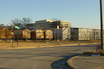 When I took these pictures, the notion of a baseball stadium anywhere in DC, let alone on South Capitol Street, was still thought of as a "maybe someday" dream, not anything that was actually only five years from opening. There was no hulking US Department of Transportation on M Street, and no public access to the entire 55-acre Southeast Federal Center with its long stretch of Anacostia waterfront. There were no parks, though there were school buses! And there were certainly no brightly colored townhouses selling for hundreds of thousands of dollars.
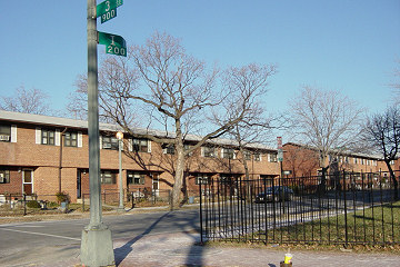 There were a couple of new office buildings built a few years earlier when NAVSEA moved to the Navy Yard, and one additional one was under construction. There was a banner announcing a coming shiny new apartment building at New Jersey and K, which my husband and I laughed at every time we saw it--who would ever want to live THERE?.
 Even in my semi-retired state, I'd like to believe it is still worth noting that Saturday marks the 10-year anniversary of my first real photographic excursion* south of the Southeast Freeway, when on lark on a cold Sunday afternoon I had my husband drive me around while I took some furtive shots with an early generation digital camera.
 There was no rhyme or reason to the pictures I took, and there certainly was no grand plan that I'd spend the next decade amassing more than 60,000 additional photos** of the changes and events along the path of Near Southeast's redevelopment.
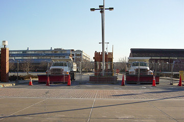

All I knew was that were some plans to redevelop the neighborhood, especially the areas along the water as well as the public housing project a few blocks south of my house. I thought it would be cool to have some "before" photos, especially having watched other areas of the city change so radically from what I had first remembered as a high schooler and then college kid in the 1980s, venturing to the original 9:30 Club or the Tiber Creek Pub. I put a few of them up on my web site (already called JDLand, I'll have you know), mainly so that my dad could see them.
 When I took these pictures, the notion of a baseball stadium anywhere in DC, let alone on South Capitol Street, was still thought of as a "maybe someday" dream, not anything that was actually only five years from opening. There was no hulking US Department of Transportation on M Street, and no public access to the entire 55-acre Southeast Federal Center with its long stretch of Anacostia waterfront. There were no parks, though there were school buses! And there were certainly no brightly colored townhouses selling for hundreds of thousands of dollars.
 There were a couple of new office buildings built a few years earlier when NAVSEA moved to the Navy Yard, and one additional one was under construction. There was a banner announcing a coming shiny new apartment building at New Jersey and K, which my husband and I laughed at every time we saw it--who would ever want to live THERE?.
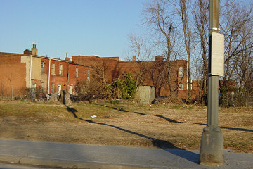
 There were a lot of small businesses, a number of carry-outs and market/liquor stores, four gas stations, concrete plants, auto repair garages, warehouses, Metrobuses, and of course nightclubs, gay and straight. And a lot of trash-strewn empty lots.
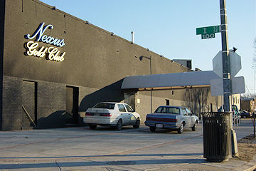

I look now at the photos from those early years, and it just doesn't seem like it can really have been 10 years. I remember when the boarded up gas station at 3rd and M was demolished in October 2003, thinking "FINALLY!"
I remember working up the courage to go to public meetings, and feeling like a dingbat trying to explain who I was ("yeah, so, I have this web site, and I, like, take pictures and stuff?").
I remember walking around the neighborhood for hours on Sunday mornings in 2006 and 2007, rarely crossing paths with another human.

I remember the exhaustion of the all-details-blogging about the construction and opening of Nationals Park, especially at the end of 2007 and beginning of 2008. I laugh about how my fraidy-cat tendencies were shoved aside while I traipsed around the site in a hard hat (me! in a hard hat!), sometimes climbing rickety ladders, to get to spots where the best pictures would be had.
I think about how it seemed like the documenting of the stadium's birth was the main subject of this site, and yet I realize that I've now written about the neighborhood for almost as long with the stadium open as not.
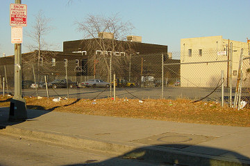

I imagine I should have some grand What It All Means theory, for the neighborhood, or for "citizen journalism" or "hyperlocal blogging," or my life, or whatever. But, mainly I'm lucky that the stars aligned to have this particular neighborhood undergo such a transformation, in a way that tied in with my history-journalism-photography-web development backgrounds (and my obsessive-compulsiveness).
I do think it's been shown, though, that a project like this isn't as easy to replicate as it might seem (so maybe I did deserve that award!).

I'm also lucky that so many people have helped me along the way, with information, tips, tutorials on commercial real estate development and construction, and zoning, and urban planning, and all the other things I really knew nothing about before I started down this path.
And I'm really lucky that over the years people who have stumbled onto the site have found it interesting, which is what has pushed me to keep going, even if it's in a somewhat less-than-optimal fashion right now. Because, really, all I wanted was some cool pictures to be able to look back on.

Without getting into detail, my pulling back somewhat has definitely been the right thing to do, and the times when I go days or even weeks without posting aren't really just me being lazy. But the funny thing is, I still research and track all the minutiae the same way--it's just that final step of writing it out that I can't always get through.
I think, though, that 2013 is going to have a lot of the "milestones" that still propel me to post--restaurants will open, other retail may come along, and maybe some buildings will get started. And there still will be pictures to be taken. Because, even if I wanted to, I don't think I could ever really stop watching the neighborhood change, and if I'm going to watch it, and photograph it, I might as well keep blabbing on about it, and might as well share it with anyone still interested.
So go look at the pictures from January 19, 2003 (and all the others that I've put online), since that's what this was really all about. And accept my deep appreciation for being along for the ride.
*I say "real excursion", and date the blog's anniversary to Jan. 19, 2003, because that was the first time I took photos and then put them on the web, and really began this life-consuming project. But I need to note that I did also take some photos of the neighborhood back in the fall of 2000, during the reconstruction of M Street and the Navy Yard's renovation for NAVSEA, with my old film camera--but I forgot about them and didn't even develop the film until sometime in 2004 (hence the rotten quality!).
**Only about one third of the photos I've taken are actually on the web site, by the way.
|
Comments (7)
More posts:
Rearview Mirror, JDLand stuff
|
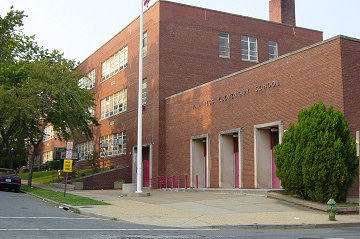 As part of a release outlining the impacts on Ward 6 of today's School Consolidation Plan announced by DC Public Schools Chancellor Kaya Henderson, Tommy Wells said this:
 "The Chancellor again committed to reopening Van Ness Elementary in near Southeast for the 2015-16 school year and expects to share further details of the academic curriculum and planning later this year."
No details beyond that morsel, but it should be welcome news for the parents of the neighborhood, who long for an elementary school close by. Van Ness, at 5th and M SE, has been closed since 2006, as the number of neighborhood school-aged children dwindled with the closing of the Capper/Carrollsburg public housing project to make way for the mixed-income Capitol Quarter townhouse development.
|
Comments (1)
More posts:
Van Ness Elementary
|
Within the past few days, readers have sent tweets with photos of brewing equipment being delivered to soon-to-be-Gordon Biersch at 100 M and inside the space at the Boilermaker Shops that will become Bluejacket.
No official timeframe on when either of these restaurants will open, though a Biersch employee told the Post that he "expects the new Biersch branch to be operating in time for the Craft Brewers Conference in March and the Nats' home opener in April."
As for the other beer joint on tap for the neighborhood (see what I did there?), there doesn't appear to be any action so far in the Willie's Brew and 'Que space at the Boilermaker Shops, but with owner Xavier Cervera's long-in-the-works redo of the Hawk 'n' Dove reportedly about to debut, perhaps he'll then be able to shift resources both to Willie's and to the Park Tavern at Canal Park.
UPDATE, 1/17: This Esquire interview with Bluejacket bigshot Greg Engert says that the bar will open "in May."
|
Comments (8)
|
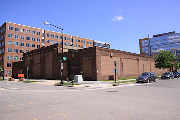
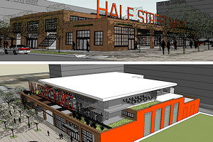
Could Near Southeast get a new "food destination"? Resident Nathan Alberg and new 6D02 commissioner Ed Kaminski are proposing that the federally owned warehouse at Half and L SE be converted to a market and community space called the "Half Street Market," and are now starting the process of drumming up support.
 Alberg, who lives just across the street and so presumably has spent a lot of time looking out his window at the warehouse, envisions the building as a site similar to Eastern Market or the new Union Market in Northeast DC, or Milwaukee's Public Market. He hopes it could "offer independent merchants a market to sell their artisan foods and prepared food products to the public, provide a managed risk incubator for self-employment, to provide public culinary training and education in a working demonstration restaurant, drive the development of new food markets, income generation, increased economic growth." In other words, it could be a combination indoor/outdoor market, cooking school, and rentable event space.
A survey to gauge interest in the idea is currently being run (so go give them your input!), and a public meeting will be held sometime in early February to discuss the notion further. This presentation was made to residents of Velocity this week, though it's stressed that these are early concepts.
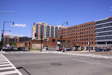 How exactly the building would go from excess GSA space to Half Street Market is a bit murky--Alberg, Kaminski, and 6D07 commissioner David Garber say that the feds are "in the process of potentially auctioning the building or possibly giving it to the city." The warehouse, built around 1924, is on a nearly 30,000-square-foot lot, which was most recently assessed at $19.2 million. Just to the south is an empty lot facing M Street where a Sunoco station once stood and is the current home to Nats Parking Lot J.* Those two lots together, creating a block the same size as the 80 M office building, directly across M Street from the Navy Yard Metro station and a block away from Nats Park, would presumably be pretty appetizing to deep-pocketed developers, so if the warehouse property were to go to auction, it probably wouldn't be sold on the cheap.
What do you think, readers?
(* Side note: The old Sunoco site has been known as 50 M Street, being marketed by Monument Realty and owned in a partnership by Monument, MacFarlane, and Lehman. But my understanding is that, with the property being worth less than the loan, and with Lehman also being the lender on the loan, this site, along with the lot on the old BP site at Half and N that had the same ownership configuration, has gone through "foreclosure" in recent days so that Lehman now is the sole owner.)
|
Comments (19)
|
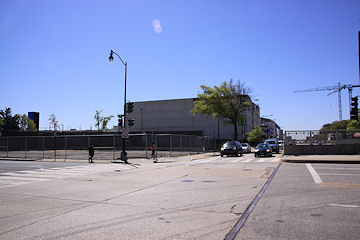

On January 17, the Zoning Commission will be taking up a Capitol Gateway Overlay Review request from Monument Realty for "One M Street," an approximately 328,000-square-foot office building planned for the southeast corner of South Capitol and M streets, SE, on what old-timers know as the old Domino's site, just to the north of the self-storage building.
The building, which is referred to in the zoning submittals as a speculative development, would have a large lobby entrance at the corner of South Capitol and M and somewhere between 9,000 and 17,260 square feet of ground-floor retail, plus four floors of underground parking with 310 spaces. It would be 12 stories high along M Street, but as seen in the above rendering grabbed from the documents, the height along South Capitol would be lower, because of the "different characters" of the two streets. You can see another rendering of the building, as seen from M Street at Van, here.
This has also been referred to the National Capital Planning Commission for review, and ANC 6D will of course be getting a crack at it as well. There's no estimated timeline mentioned in the zoning documents. (But we know how I feel about "estimated" start dates these days anyway. Show me a shovel in the ground!)
Monument has owned the Domino's parcel on the corner since 2005, and added the L-shaped parcel to its east and south in 2008 as part of its settlement with WMATA over not getting the Southeastern Bus Garage site just to the east. Monument, as most people know, built quite a portfolio of land in the blocks just to the north of Nationals Park in 2004 and 2005, having completed 55 M Street in 2009 and still controlling the rest of the land on the east side of Half Street, along with the old Sunoco site on the northeast corner of Half and M and the old BP/Amoco site on the northeast corner of South Capitol and N.
|
Comments (1)
|
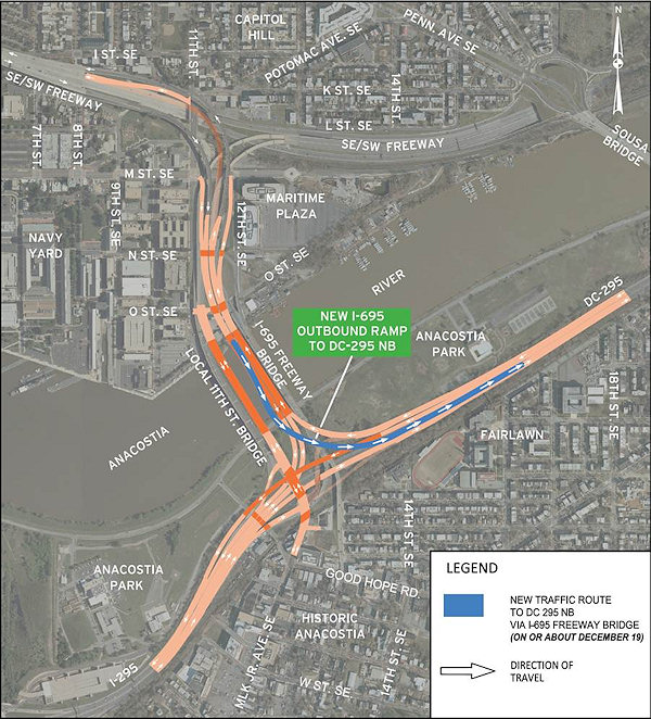 UPDATE, Dec. 19: A tweet from DDOT confirms that the new ramp is "slated to open this afternoon, possibly in time for evening rush hour." UPDATE TO THE UPDATE: According to NBC4's Adam Tuss, the ramp is now open.
Original post: Just out from DDOT, an announcement that the long-awaited ramp from the outbound 11th Street freeway bridges (now known as I-695) to DC-295 northbound is expected to open "on or about December 19." This means that vehicles traveling eastbound on the southeast freeway can now remain on the freeway for their entire trip to DC-295 northbound, instead continuing along the stub of the Southeast Freeway ending at Barney Circle, then traveling across the Sousa Bridge to then endure a nightmare left turn onto DC-295.
Not mentioned in the announcement is whether at the same time the old route to Pennsylvania Avenue will be closed--if it doesn't close the 19th (see Update II below), it will be closing soon, as part of the two-year reconfiguration of that road as "Southeast Boulevard."
{I'm psychic!}
UPDATE: I should also note that, according to the graphic at right, eastbound freeway traffic will start being routed (temporarily!) on the new flyover built during the past few years that will eventually carry inbound traffic; but using it for outbound traffic at this point allows the existing older outbound flyover to be demolished to make way for a new outbound flyover. Photos and additional explanations here and here.
UPDATE II: However, if you're used to getting onto the eastbound freeway and 11th Street Bridges via the ramp at 8th and Virginia, be advised that ramp will close when demolition begins of the old outbound flyover, which is expected to start in late January. And, to answer another lingering question from this post, that's when the eastbound freeway east of 8th will be closed, which also means that the little ramp from 9th and Virginia to the eastbound freeway stub will be closed as well. (This all from @DDOTDC on Twitter.) You'll be able to access the new ramp to DC-295 northbound by getting on eastbound I-695 via the new-ish ramp on the southeast corner of 11th and M; in fact, the entrance lane from that ramp I believe puts you directly in the DC-295 NB exit lane. Or, if you're on the western end of the neighborhood, you can get on the eastbound freeway at South Capitol Street (only in my fever dreams).
|
Comments (7)
More posts:
11th Street Bridges, Southeast Blvd.
|
If you're wondering how come I haven't posted that much lately, it's because a few months ago I decided I was only going to post about "big news", and there's been a bit of a lull in that department. But I still do pass stuff along on Twitter, which you can see in the Twitter box here on the JDLand home page and which also mostly gets cc'ed to the JDLand Facebook page. That's where you can keep up all sorts of little things about the neighborhood that aren't really blog-post-worthy.
I think there will be some posts coming before too long--a few things seem to percolating around that may draw me out soon, plus there's that ramp from the outbound 11th Street freeway bridges to northbound DC-295 should be coming before too long (UPDATE, five hours later: yes, indeedy). There's not always a lot of news in December, anyway. And not a lot of stuff to take updated photos of right now.
Just didn't want people to think I'd completely closed up shop.
But, if there's anything that I'm being too lazy to post about that folks want to discuss, have at it in the comments. (Suggested topics for discussion: the Navy Yard keeping their portion of the RIverwalk closed because they haven't yet fixed the security issues with the turnstiles into their campus, and Xavier Cervera perhaps selling off his restaurant empire, including the not-yet-opened Park Tavern at Canal Park and Willie's Brew and 'Que at the Boilermaker Shops.)
|
Comments (5)
More posts:
JDLand stuff
|
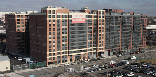 It's taken almost a year, but the sale of 70 I Street was completed this week, with public records showing that "70 Eye Street Acquisition LLC" paid $165.7 million for the 448-unit building developed by JPI and opened in 2008.
 The other two buildings in the original JPI "Capitol Yards" lineup, 100 I and 909 New Jersey, were sold back in May for around $94 million each, but the 70 I sale took longer as tenants had attempted to purchase the property themselves (UPDATE: or at least to file that paperwork in order to then attempt to negotiate terms of sale more favorable to residents). I don't have this confirmed, but I am assuming that the 70 I LLC, like the other two, is "institutional investors advised by J.P. Morgan Asset Management," since the 70 I sale deed has Morgan as the mailing address for the LLC.
Like the other properties, 70 I will be managed now by Bozzuto, which, in a letter to tenants, also said that the name of the property once known as the Jefferson at Capitol Yards is now changed to "70 Capitol Yards." (This is why I always just keep with the addresses.)
|
Comments (1)
More posts:
70/100 I, Development News
|
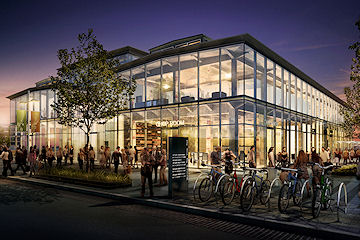 Forest City Washington is announcing today that a "modern Mexican" restaurant to be called Agua 301 will be coming to the Lumber Shed building at the Yards next summer.
 The 3,600-square-foot restaurant, to be located on the Shed's southwest corner (nearest to the Yards Park's pedestrian bridge) is coming from the creators/owners of Zest Bistro on Barracks Row, and takes its name from the address of the Lumber Shed, at 301 Water St., SE. The menu is being developed by Zest's executive chef, Dot Steck.
The Lumber Shed is already the announced location of Italian restaurant Osteria Morini (on the building's southeastern corner) and has spaces still to lease for three additional restaurants.
The press release from Forest City also says that Bluejacket and Buzz Bakery are still expected to open in the Boilermaker Shops in the "first quarter" of 2013, with Willie Brew and 'Que opening there "by spring." UPDATE: But one thing I am noticing that isn't mentioned in the press release: any reference to Huey's 24-7 Diner, which was one of the originally announced restaurants for the Boilermaker Shops. Hmmm. Anyone close by want to check and see if that banner has been pulled down from the Boilermaker facade?
|
Comments (29)
|
A release just out from DDOT is announcing that the new ramp from 11th Street SE to the westbound Southeast/Southwest Freeway wll be opening on Thursday, Nov. 29. This means that vehicles from the eastern ends of Capitol Hill and Near Southeast won't have to drive along Virginia Avenue to the 3rd Street SE on-ramp anymore; it will also give easier westbound freeway access to traffic coming inbound on the 11th Street Local Bridge.
Also on Nov. 29, the westbound portion of the sunken SE Freeway between Pennsylvania Avenue/Barney Circle and 8th Street SE will be fully closed, as work continues on creating the new "Southeast Blvd." Drivers heading south on DC-295 who have long exited onto Pennsylvania to go west on the SE/SW Freeway will be directed to use the inbound 11th Street Freeway Bridge.
I wrote a lot about these changes back in September, so I'll just point you to those three posts for additional information and photos, or you can wander through my 11th Street Bridges project page.
|
Comments (4)
More posts:
11th Street Bridges, Southeast Blvd.
|

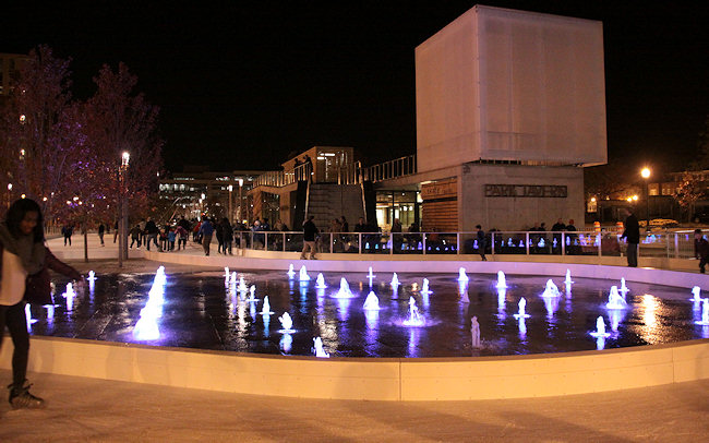
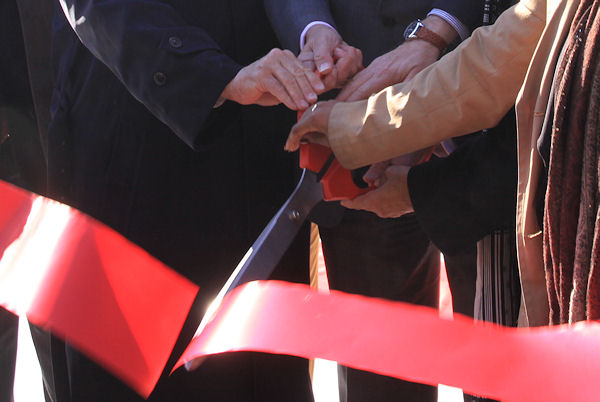 I've been to a fair number of ribbon cuttings over the past decade, and I have to say that Friday's opening of Canal Park seemed to be infused with a level of excitement and joy that I don't think I've seen at any of the others.
 While getting Nationals Park open in 2008 was a triumph of speed and scale, the 13-year journey of the three-block park at the heart of Near Southeast required so many hands and so much patience and resulted in a space with which the stakeholders are clearly thrilled that it shouldn't really be a surprise that on a gorgeously crisp late fall day so many attendees were walking around with what Tommy Wells described as "a huge smile on their face."
The speakers standing at a podium in the center block's small pavilion ran through the list of names and agencies that brought the park to fruition, starting with developer William C. Smith, whose CEO Chris Smith started the long drive to build the park, creating the Canal Park Development Association back in 2000. Then there was money from the federal government and the DC government, additional dollars and much support from the DC Housing Authority, work by OLIN landscape architects and STUDIOS architecture to design the park with innovative sustainable development and storm water management components (and a skating rink!). Props were given for the hiring of Housing Authority residents for 15 of the park's 25 part-time jobs.The Capitol Riverfront BID and the DC Commission on the Arts and Humanities also took bows for their parts in the park's creation (and future).
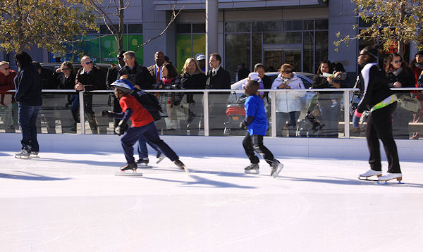 After the speeches, the festivities moved to the skating rink, where the ribbon was cut and Mayor Gray drove the Zamboni, and then the public laced up its skates and got out on the ice. And they kept skating, well into the night. (And I have no doubt there will be big crowds at the rink and park today as well.) For all the happiness seen in the park's founders about getting it finally opened, I saw equal measures of surprise and cheer that so many residents and neighborhood office workers had come to the opening, had stayed through the long speechifying, and now were skating and strolling.
I've joked that I sure have been saying the word "finally" a lot lately--the trash transfer station is finally demolished, Kruba Thai is finally open, Gordon Biersch finally admitted they're coming to 100 M, Vida Fitness is finally announced, Capitol Quarter is finally finished.... But it's the "finally" of Canal Park opening that hit me more than I expected, perhaps similarly to all those happy stakeholders.
I took a lot of photos of fenced-off schoolbuses in the early years, posted a lot of renderings (some for the park's first design that never materialized), and bugged a lot of people to find out the latest. It was, after all, one of the few projects that was already in planning when I started tracking Near Southeast in early 2003, along with the Capper redevelopment and Capitol Hill Tower.
And now the park is open (with the Park Tavern restaurant to follow "within a few weeks"), and everybody can enjoy it. Finally!
Hope you'll check out my photo galleries of the park, yesterday's ceremonies, and the park's opening night, along with my expanded gallery of before-and-afters from around the park (with some that I still need to fill in, oops). And you can also see coverage from the Post, NBC4, and WJLA. And the lineup of today's events and other details on the park's official web site. And tell us what you think of the park.
|
Comments (5)
|
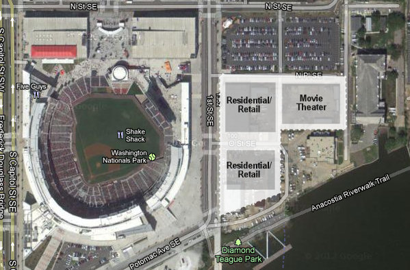 At a public meeting on Thursday night, Yards developer Forest City Washington presented very early plans for the portion of the DC Water/WASA site on 1st Street that the company is currently working to secure the development rights for.
 While people are always interested in projects for more residential buildings with ground-floor retail, it was the plans for a movie theater on the site that drew a decent-sized crowd to the meeting, and the attendees learned that Showplace Icon is the heretofore unnamed operator that Forest City is currently in negotiations with.
It would be a 16-screen theater with more than 2,000 seats on N Place SE (see my quickie map for placement in regards to Nats Park and the main WASA pumping station), and Icon's more upscale amenities and approach to movie-going were extensively touted, including all reserved seating, VIP areas in each theater with extra-wide seats and person tables, wall-to-wall and ceiling-to-floor digital screens, no on-screen pre-show advertising, fresh-not-frozen food prepared on site, and their "lobby lounge," with about 100 seats and 21-and-over-only admittance.
But it was Icon's "policies to encourage courteous behavior" that seemed to defuse the "ZOMG GALLERY PLACE" concerns about the theater that had been cropping up on neighborhood mailing lists and elsewhere over the past few weeks. The theaters will not allow children under 17 after 7 pm without an adult, no one is admitted after the movie starts, no children under seven are admitted to PG-13 or R movies after 7 pm, and the adult admission price also applies to children.
Bob Gallivan of Kerasotes Showplace Theaters said that the company's theaters in Chicago and suburban Minneapolis are "bringing people back to the movies who haven't been for awhile" thanks to these policies, because they are trying to "create a civilized atmosphere." ("We're not a babysitting service," he also said.)
Thanks to being an all-digital theater, the venue would also be able to offer other content, such as simulcasts of the Metropolitan Opera, sporting events, and other events. And the theater would also have some small retail and maybe artist space along N Place.
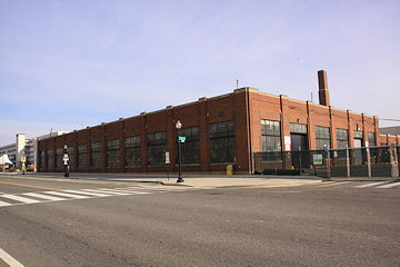 As for the rest of the plans for the site, along 1st Street across from Nationals Park there would be two residential buildings, totalling 625ish units, each with ground-floor retail; and the northern one of the two would incorporate the brick/industrial facade of the existing DC Water fleet management building on 1st between N Place and O (seen at left).
 O Street would be re-established from 1st east to the new 1 1/2 Place, and Potomac Avenue would be extended east from 1st as well to 1 1/2 Place.
Forest City's planners envision a "lower-scale" retail experience along 1 1/2 Place (smaller "eclectic" retailers, not "low-end"), with more "large-scale" offerings long 1st thanks to the size of the street and its location across from the ballpark. All told this area of the Yards would have about 50,000 square feet of retail.
Diamond Teague Park would also be expanded somewhat to the north of its current footprint, up to the new Potomac Avenue. It's possible that Potomac Avenue and the lower part of 1 1/2 Place could be closed at times for street festivals, etc.
As for any timeline on all of this, first Forest City has to actually acquire the land from DC Water and the city, and then has to complete the negotiations with Showplace Icon. (The fact that Forest City has even named Icon before executing the lease is a pretty big departure for the company, and shows an understanding of the need to clearly define what sort of theater experience would be on the boards.) Then the project has to go through the zoning process (it will be a PUD), and then get building permits. Forest City "hopes" to begin the approximately two years of construction for the theater in 2014, but that's a lot of ducks to get in a row first. (The residential buildings would come later.)
Audience members had questions about security (Icon uses off-duty police in Chicago, and Forest City would have its own security as well), types of films that would be offered (art-house and blockbusters), worries that the Lobby Lounge might become a club (not an issue, Icon says), and how traffic generated by the development would co-exist with 40,000 fans one block away at Nationals Park 81 nights a year (or more!). Because it's still early in the process, there weren't concrete answers to some of the concerns, but this project still has to go before ANC 6D and the Zoning Commission before being approved, so there will be plenty of opportunities for additional detail to be insisted upon.
Should I mention again that this is all still subject to both the DC Water land deal and the lease with Icon getting finalized?
Much more to come on this, obviously. And, for people who weren't at the meeting who didn't get to see any of the EARLY CONCEPTUAL NOT FINALIZED drawings, I have asked for at least the EARLY CONCEPTUAL NOT FINALIZED rendering of the glass-walled theater exterior to post, and hopefully before too long Forest City will be ready to share it.
|
Comments (13)
|
This Thursday, Nov. 15, at 7 pm, there is a public meeting being hosted by ANC commissioner David Garber about the proposed movie theater at the Yards.
Yards developer Forest City Washington will be there, plus their planners and architects. Also in attendance will be what Forest City took pains to emphasize to me is the prospective theater operator, because no deals have been signed, and because (as we all found out with Vida Fitness), Forest City never confirms a specific tenant until a lease has been executed. (They're not even naming who this prospective operator is in advance of the meeting.)
There will be some draft images of potential designs for discussion and feedback, but this is earlier in the process than these sorts of presentations are often given, so don't be looking for firm plans just yet.
As I wrote when this news first broke in September, developer Forest City Washington is working on bringing a theater operator offering an "elevated experience" to land currently controlled by DC Water along First Street SE between Nationals Park and the Yards, along with residential and retail. But the deal with DC Water for the site is still not finalized, let alone the theater lease, so none of this is happening next week.
The meeting is at 200 I Street SE (aka 225 Virginia Avenue, aka the old Post Plant, aka the old Star Plant) at 7 pm.
|
Comments (2)
|
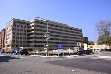
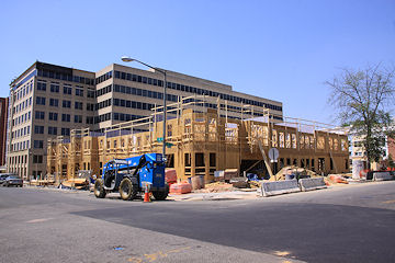
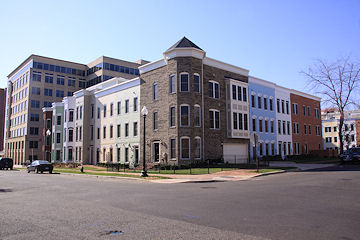
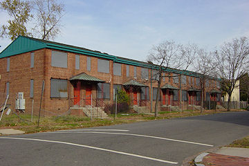
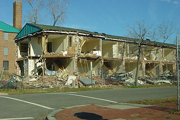
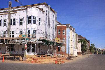
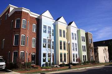
For close to 10 years, there has almost always been something going on to photograph between 5th, 3rd, L, and Virginia. Between 2003 and 2007 there was the boarding up and demolishing of the old Capper/Carrollsburg dwellings and the construction of the two new Capper apartment buildings. Then, in 2008, work finally began on Capitol Quarter's mixed-income townhouses, starting at 5th and L and working northward then back southward.
And now, as 2012 comes to a close, the final batch of homes, on the south side of L between 3rd and 4th, have been completed, and with the photos I took Sunday, my work in the Capitol Quarter blocks is done.
There will be more to come at Capper--apartment buildings are still to be built on the empty lots between 2nd and 3rd, and on the trash transfer site, and at the old Capper Seniors site at 7th and L, plus office buildings at 250 M and 600 M--but until those get underway (timelines all currently unannounced), my days of traipsing around the old Capper footprint with camera in hand are at an end.
I've taken more than 5,000 photos of just this portion of Near Southeast, and while not all of them are on the web site, if you go to the Photo Archive map and click on a star or use the search form, you can follow the progression I've witnessed at the 14 Capitol Quarter intersections (such as the one above, showing the southwest corner of 4th and L from 2006 to 2012, and the one below, showing the northeast corner of 4th and K from 2004 to 2009).
The photos, of course, mostly just track the physical change, and don't really reflect how these blocks now have so much more foot traffic, so many more strollers, and so many more bikes (and so many more shades of pastels on the buildings!). The photos probably do hint at the, ahem, shift in demographics from a nearly 100 percent public housing community to a mixed-income area that includes some of those previous public housing residents alongside newcomers who've paid close to $1 million for their new homes, which probably still elicits a grumble here or there, though that's also an on-going discussion across the city, not specific just to Near Southeast.
But for those of us who saw what this area south of the freeway had looked like for so many years, there can still be moments of wonder that this redevelopment actually happened. It's been amazing to watch, and I'm so glad I got to see it up close from start to finish.
|
Comments (16)
|
|
Comments (3)
|
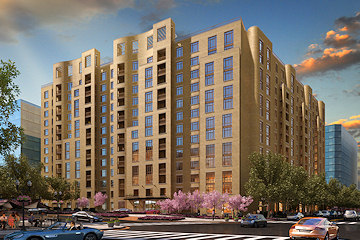 While there's been a lot of work going on at the site since the beginning of the year, it's only now that it can truly be said that work has begun on the 432-unit Park Chelsea apartment building at New Jersey and I Streets, SE.
 Developer William C. Smith has closed on a $100 million construction loan (which they are calling the largest one secured for a DC residential project this year), and if you look down on the site from on high, you can definitely see earth being moved, separate from the huge shafts built over these past few months to facilitate the relocation of deep infrastructure beneath the site. (There was also that whole demolishing of the trash transfer station just to the south of the project's footprint, since a small corner of that old building extended onto the Park Chelsea land.)
The cost of the entire project is pegged at $150 million.
The Park Chelsea is expected to deliver late in 2014, and will have three levels of below-grade parking, both indoor and outdoor pools, a rooftop garden with a dog park, an electric car charging station, and a "state of the art bike storage and maintenance area." It's also just the first phase of the development of the entire block bounded by New Jersey, 2nd, H, and I, which is expected to have 1,200 residential units and 75,000 square feet of retail when it is all completed; plus, H and I streets will be built through between 2nd and New Jersey. It's also just a few steps away from the so-close-to-opening-you-can't-believe-it Canal Park.
The Park Chelsea is now the second new-construction multi-unit residential building to start in Near Southeast in 2012, along with Forest City's Twelve12 apartment building (home also to Harris Teeter and Vida Fitness) at the Yards.
|
Comments (0)
|
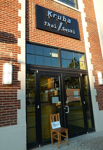 A tweet just out from the Capitol Riverfront BID says that Kruba Thai is now open, although with the caveats that the full Thai menu is available, but alcohol and sushi aren't yet, so definitely consider this a "soft opening."
If you swing by and check out this temporarily liquor-free version, post your thoughts in the comments.
Even without the alcohol, Kruba is now the first sit-down/table-service restaurant to open in Near Southeast since Justin's Cafe arrived in spring 2010.
For those who haven't followed closely, Kruba is in the southwest corner of the ground floor of the Foundry Lofts building, just north of the Yards Park on 3rd Street, SE.
UPDATE: I wandered down, and they are indeed open. A couple of photos:
|
Comments (9)
|
Elections are a very (very!) busy time for me in my "real" life, so I can tear away for just a moment to pass along the news that Ed Kaminski has won the race for the newly drawn ANC 6D02, with 485 votes to Damon Patton's 376. (So that's 54-42 if you don't feel like doing the math.) There were also 40 write-in votes, most of which presumably were for current 6D02 commissioner Cara Shockley.
David Garber, running unopposed in 6D07, garnered (Garbered?) 642 votes, with 37 write-ins.
As for the rest of ANC 6D, commissioners Andy Litsky, Ron McBee, Roger Moffatt, and Rhonda Hamilton are all returning, and Donna Hopkins is now the new commissioner for ANC 6D01. (Grace Daughtridge, running against Moffatt, had kind of a rough Election Day.)
If you want to see vote totals, here's the DCBOEE site.
Now, back into my election cave for a little while longer....
The Washington Business Journal confirms today what I've been chasing and rumoring for just over a year now, that brewery/restaurant Gordon Biersch is indeed coming to 100 M, the office building on the northeast corner of 1st and M, SE, one block north of Nationals Park.
No timetable was announced, but you'd think Opening Day 2013 would certainly be a goal. (Then again, we once thought that Opening Day 2012 would be a goal.)
The building permit application I saw a few weeks ago that I assumed was Biersch indicated the restaurant will have up to 236 seats indoors, and 94 outdoors.
|
Comments (4)
|
2918 Posts:
Go to Page: 1 | ... 15 | 16 | 17 | 18 | 19 | 20 | 21 | 22 | 23 ... 292
Search JDLand Blog Posts by Date or Category
Go to Page: 1 | ... 15 | 16 | 17 | 18 | 19 | 20 | 21 | 22 | 23 ... 292
Search JDLand Blog Posts by Date or Category


