
|
| |||||||||||||||||||

|
Please note that JDLand is no longer being updated.
peek >>
Anacostia Riverwalk Trail
(Near Southeast Portion)
Planned 20-mile multi-use trail along the east and west banks of the Anacostia River
- Full Neighborhood Development MapThere's a lot more than just the projects listed here. See the complete map of completed, underway, and proposed projects all across the neighborhood.
- What's New This YearA quick look at what's arrived or been announced since the end of the 2018 baseball season.
- Food Options, Now and Coming SoonThere's now plenty of food options in the neighborhood. Click to see what's here, and what's coming.
![-]()
- Anacostia RiverwalkA bridge between Teague and Yards Parks is part of the planned 20-mile Anacostia Riverwalk multi-use trail along the east and west banks of the Anacostia River.
![-]()
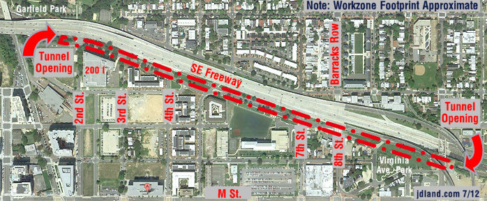
- Virginia Ave. Tunnel ExpansionConstruction underway in 2015 to expand the 106-year-old tunnel to allow for a second track and double-height cars. Expected completion 2018.
![-]()
- Rail and Bus Times
Get real time data for the Navy Yard subway, Circulator, Bikeshare, and bus lines, plus additional transit information. - Rail and Bus Times
Get real time data for the Navy Yard subway, Circulator, Bikeshare, and bus lines, plus additional transit information. - Canal ParkThree-block park on the site of the old Washington Canal. Construction begun in spring 2011, opened Nov. 16, 2012.
![-]()
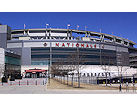
- Nationals Park21-acre site, 41,000-seat ballpark, construction begun May 2006, Opening Day March 30, 2008.
![-]()
- Washington Navy YardHeadquarters of the Naval District Washington, established in 1799.
![-]()
- Yards Park5.5-acre park on the banks of the Anacostia. First phase completed September 2010.
![-]()
- Van Ness Elementary SchoolDC Public School, closed in 2006, but reopening in stages beginning in 2015.
![-]()
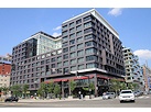
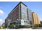
- Agora/Whole Foods336-unit apartment building at 800 New Jersey Ave., SE. Construction begun June 2014, move-ins underway early 2018. Whole Foods expected to open in late 2018.
![-]()
- New Douglass BridgeConstruction underway in early 2018 on the replacement for the current South Capitol Street Bridge. Completion expected in 2021.
![-]()
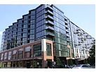
- 1221 Van290-unit residential building with 26,000 sf retail. Underway late 2015, completed early 2018.
- NAB HQ/AvidianNew headquarters for National Association of Broadcasters, along with a 163-unit condo building. Construction underway early 2017.

- Yards/Parcel O Residential ProjectsThe Bower, a 138-unit condo building by PN Hoffman, and The Guild, a 190-unit rental building by Forest City on the southeast corner of 4th and Tingey. Underway fall 2016, delivery 2018.
- New DC Water HQA wrap-around six-story addition to the existing O Street Pumping Station. Construction underway in 2016, with completion in 2018.
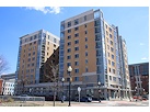
- The Harlow/Square 769N AptsMixed-income rental building with 176 units, including 36 public housing units. Underway early 2017, delivery 2019.
- West Half Residential420-unit project with 65,000 sf retail. Construction underway spring 2017.
![-]()
- Novel South Capitol/2 I St.530ish-unit apartment building in two phases, on old McDonald's site. Construction underway early 2017, completed summer 2019.
![Novel South Capitol]()
- 1250 Half/Envy310 rental units at 1250, 123 condos at Envy, 60,000 square feet of retail. Underway spring 2017.
![-]()
- Parc Riverside Phase II314ish-unit residential building at 1010 Half St., SE, by Toll Bros. Construction underway summer 2017.
![-]()
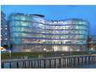
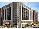
- 99 M StreetA 224,000-square-foot office building by Skanska for the corner of 1st and M. Underway fall 2015, substantially complete summer 2018. Circa and an unnamed sibling restaurant announced tenants.
![-]()
- The Garrett375-unit rental building at 2nd and I with 13,000 sq ft retail. Construction underway late fall 2017.
![-]()
- Yards/The Estate Apts. and Thompson Hotel270-unit rental building and 227-room Thompson Hotel, with 20,000 sq ft retail total. Construction underway fall 2017.
![-]()
- Meridian on First275-unit residential building, by Paradigm. Construction underway early 2018.
![-]()
- The Maren/71 Potomac264-unit residential building with 12,500 sq ft retail, underway spring 2018. Phase 2 of RiverFront on the Anacostia development.
![-]()
- DC Crossing/Square 696Block bought in 2016 by Tishman Speyer, with plans for 800 apartment units and 44,000 square feet of retail in two phases. Digging underway April 2018.
![DC Crossing]()
- One Hill South Phase 2300ish-unit unnamed sibling building at South Capitol and I. Work underway summer 2018.
![One Hill South Phase 2]()
- New DDOT HQ/250 MNew headquarters for the District Department of Transportation. Underway early 2019.
![New DDOT HQ]()
- 37 L Street Condos11-story, 74-unit condo building west of Half St. Underway early 2019.
![37 L Condos]()
- CSX East Residential/Hotel225ish-unit AC Marriott and two residential buildings planned. Digging underway late summer 2019.
![CSX East Residential/Hotel]()
- 1000 South Capitol Residential224-unit apartment building by Lerner. Underway fall 2019.
![1000 South Capitol Residential]()
- Capper Seniors 2.0Reconstruction of the 160-unit building for low-income seniors that was destroyed by fire in 2018.
![1000 South Capitol Residential]()
- Chemonics HQNew 285,000-sq-ft office building with 14,000 sq ft of retail. Expected delivery 2021.
![1000 South Capitol Residential]()


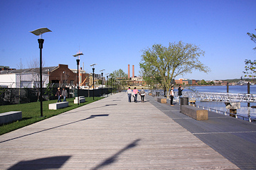
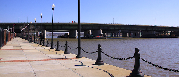
 May 28, 2016 - The western bank of the Anacostia River, and the southwestern stretch of the Anacostia Riverwalk Trail, as seen from the viewing platform at Nationals Park. If you want to take a walk along the Riverwalk, try starting just across the street from the ballpark's grand staircase at the corner of 1st Street and Potomac Ave., SE. Take the crosswalk toward the Old Capitol Pumphouse, which marks the location of Diamond Teague Park and Piers, then turn left on the boardwalk. By late 2016 the new public plaza in front of the pumphouse and east of the Dock 79 apartment building on the old Florida Rock site should be completed.
 April 17, 2016 - A new stretch of the Riverwalk is expected to open later in 2016, running in front of Dock 79 east of Teague Park.

DDOT's map of the trail's status, as of early 2012. Near Southeast's completed portions of the trail are marked as numbers 3, 4, 5, 6, 7, and 15. (See full-sized version.) Still to be completed is 18, the Florida Rock portion.
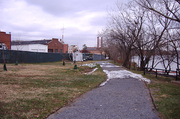
In 2005, the river's edge near the old Capitol Pumphouse had recently been the recipient of some nice landscaping and path work by members of the Earth Conservation Corps. (12/12/05)
The same location, in April 2010, about six months after Diamond Teague Park's construction was completed. (4/10/10)

Up until 2011, there was no way to walk northeast along the river from Diamond Teague Park. The view seen here is to the under-construction Yards Park. (4/10/10)
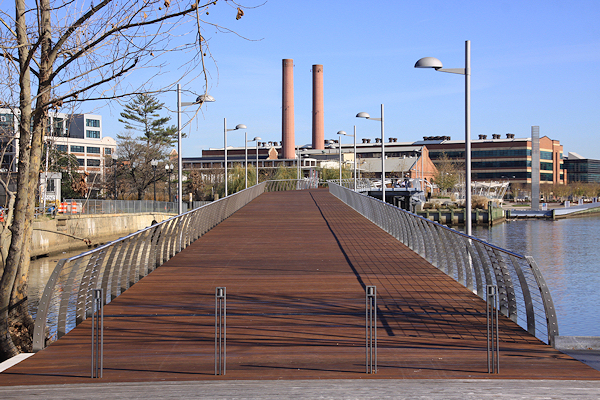
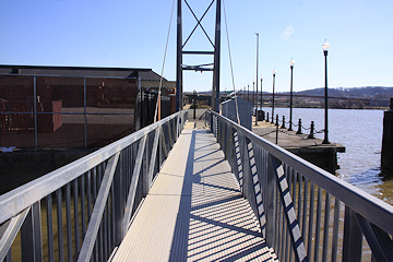
The same location, a few days after the new bridge connecting the two parks opened. (11/25/11)
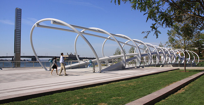
An information display on the new bridge, which crosses in front of DC Water's historic O Street Pumping Station building. For more images of the new bridge, see this gallery. (11/25/11)
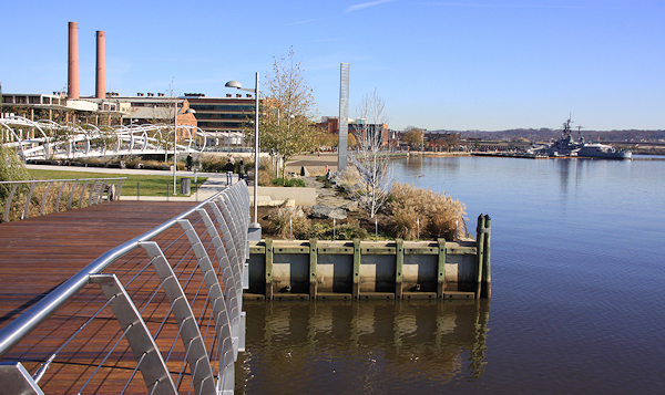
Coming to the end of the bridge, and arriving at the Yards Park, with the Navy Yard's Display Ship Barry getting closer. Unfortunately, in May 2016 the Barry was towed away from its home of 30 years. (11/25/11)

Turning back to look at the bridge just crossed. Note Nationals Park at rear center. The concrete tower at far left, on the Florida Rock site, was demolished a few weeks after this photo was taken. (11/25/11)
The Yards Park is a six-acre public park that opened in September 2010, with all manner of striking features and distinct sections. (I'll be focusing on its boardwalk portion on this page; see my Yards Park page for much more information.) (9/7/10)
Construction of the boardwalk near the Yards Park overlook, in spring 2010. (5/25/10)
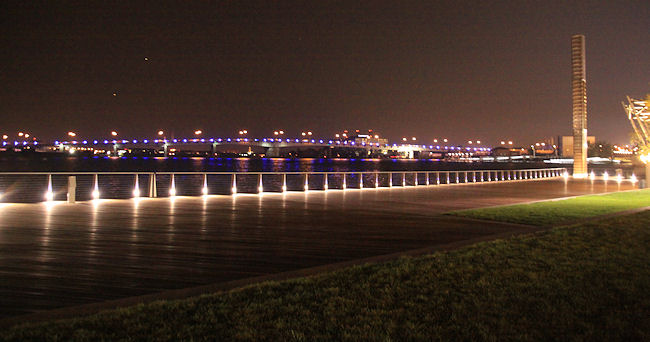
Nighttime along the Yards Park boardwalk, with the blue lights of the Douglass Bridge at rear. (9/24/10)
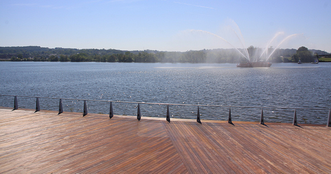
And sometimes you should actually turn and look at the river. This is the view of the day of the park's ribbon cutting, with DCFD's fire boat the John Glenn providing some entertainment. Poplar Point and the eastern branch of the trail are across the way. (9/7/10)

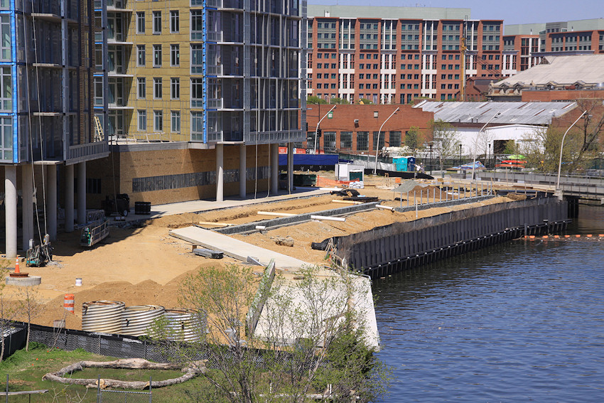
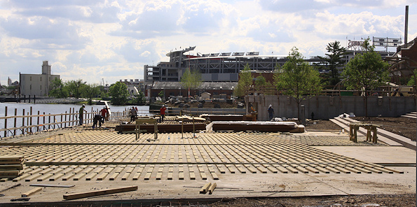
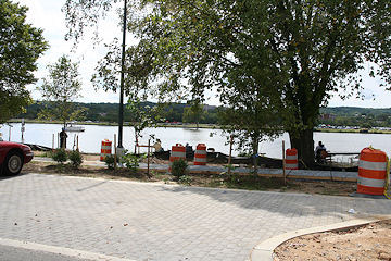
March 7, 2016 - A new addition to the Riverwalk and the Yards Park in summer 2016 will be a 50-slip marina, seen here still under construction.

Standing near the river's edge in the footprint of what would become the Yards Park, in May 2009. This area was formerly part of the Southeast Federal Center, and before that, the Navy Yard (when it stretched much farther west than it does today.) (05/09)
 June 9, 2016 - A slightly different angle of the same location, minus the Display Ship Barry.
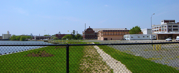
The Navy Yard's portion of the Anacostia Riverwalk was finished long before other sections, such as the boardwalk at the Yards Park, but full unfettered public access did not come until spring 2012. The top photo shows the view into what was then the Southeast Federal Center in April 2004; the bottom photo, in February 2012, reflects how things have changed in eight years. Nationals Park is at rear center. (2/26/12)
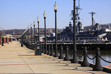
A zoomed view northeastward along the Navy Yard's riverwalk. See my Navy Yard page for additional photos.(2/26/12)
A steel bridge across one of the Navy Yards' old inlets, from when ships were actually built there. (2/26/12)
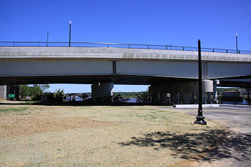
The eastern end of the Navy Yard's portion of the Anacostia Riverwalk, as it heads toward its exit at 11th Street. The old outbound 11th Street Bridge is visible, for now. (2/26/12)
It used to be when you exited the east end of the Navy Yard portion of this riverwalk, this was the view you were greeted with. (11/13/05)
May 26, 2013 - The same location, now just a wee bit different in all directions. 


In 2013, the trail area just to the south of 11th Street and east of the Navy Yard Riverwalk was cleaned up and rehabbed, on the footprint where the old outbound 11th Street Bridge used to stand. (5/26/13)
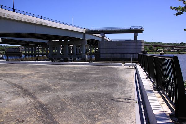
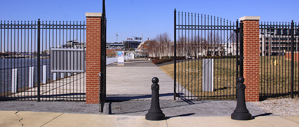
Also built at the foot of 11th Street is a new landing right alongside the river. And, jutting out from the new 11th Street Local Bridge are two new overlooks with panoramic views of the river and its surroundings. This new local bridge also has a wide pedestrian path that will allow for easy connections to and from the eastern and western portions of the Riverwalk. (5/26/13)

East of 11th Street, the trail currently diverges into two parts. This is the section that runs on M Street, seen here looking east at what would be about 13th Street. (5/31/10)

Back in the day, the path along the river ran in front of the Anacostia Community Boathouse area and the two brick storage buildings, both of which are gone now, replaced by the new 11th Street Bridges. (10/07)
Construction on the trail, along the far eastern portion of M Street, in August 2008. (8/23/08)

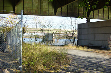
Hard to tell what you're seeing here, but at far right is where the trail passes under the Sousa Bridge, and outside of my current photo-taking territory. It continues toward RFK and eventually to Benning Road, and a bridge across the railroad tracks just north of this location is opening on April 24, 2012. (8/23/08)

When the Douglass Bridge was rehabbed in 2007, a concrete divider with nice new wrought iron fences served to spruce up the pedestrian path, but it's still narrow. It does take users directly to Poplar Point and the eastern part of the riverwalk, at least. And eventually a new Douglass Bridge will have much wider paths and better connections. (8/29/07)
Latest News
November 3, 2019
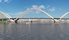
The New Douglass Bridge: A Look Ahead to the West Traffic Oval
October 6, 2017
Friday Tidbits: Playoffs, Willow, Dockside, and More
November 23, 2016
Wednesday Tidbits: Pre-Turkey Day Offerings
October 19, 2016
A Belated Look at the New Plaza and Riverwalk Extension
November 8, 2015
Vertical Construction Completed on Dock 79 at Florida Rock Site
April 25, 2014
Friday Tidbits: More, More, More (and Less) Edition
March 19, 2013
Latest 11th Street Bridges Overlook/Trail Renderings
February 11, 2013
Retail, Restaurant, and Recreation News (New and Old)